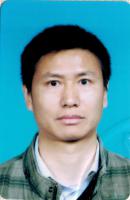
-
所属院校:河南理工大学
-
所属院系:--
-
研究领域:激光雷达遥感/数字摄影测量
-
职称:讲师
-
导师类型:--
-
招生专业:--
个人简述:
王宏涛,男,汉,1979年3月生,博士,讲师。
科研工作:
科研情况:
[1] 融合机载LiDAR点云与高分影像的城市建筑物三维重建方法研究,中国科学院数字地球重点实验室开放基金项目,项目编号2016LDE001,第1名。[2] 面向灾害应急的无人机影像快速处理关键技术研究,河南省科技攻关,第1名。[3] 地下移动测量系统研发,河南省基础与前沿技术研究,项目编号162300410184,第6名。[4] 矿井多智体减灾/救灾协同作业的自主相对导航算法研究,国家基金-青年科学基金项目,已结题,第3名。[5] 大面阵数字航空摄影原理与技术,河南省基础与前沿技术研究,已结题,第7名。[6] 低空数字摄影测量关键技术在矿山沉陷区基础测绘中的应用研究,成果鉴定,第6名。[7] 常村煤矿地表移动观测及岩移规律研究,成果鉴定,第6名。论文情况:
[1] Hongtao Wang, Wuming Zhang, Yiming Chen, Mei Chen, Kai Yan. Semantic decomposition and reconstruction of compound buildings with symmetric roofs from LiDAR data and aerial imagery. Remote Sensing, 2015, 7(10): 13945-13974. (SCI)[2] Wuming Zhang, Hongtao Wang, Yiming Chen, Kai Yan, Mei Chen. 3D Building Roof Modeling by Optimizing Primitive’s Parameters Using Constraints from LiDAR Data and Aerial Imagery. Remote Sensing, 2014, 6(9): 8107-8133. (SCI)[3] Wuming Zhang, Yiming Chen, Hongtao Wang, Mei Chen, Xiaoyan Wang, Guangjian Yan. Efficient registration of terrestrial LiDAR scans using a coarse-to-fine strategy for forestry applications. Agricultural and Forest Meteorology, 2016, 225:8-23.(SCI)[4] Wuming Zhang, Jianbo Qi, Peng Wan, Hongtao Wang, Donghui Xie, Xiaoyan Wang and Guangjian Yan. An Easy-to-Use Airborne LiDAR Data Filtering Method Based on Cloth Simulation. Remote Sensing, 2016, 8(6): 501. (SCI)[5] 王宏涛,王变利,融合LiDAR和多光谱影像的建筑物自动检测,测绘科学,2015,40(8): 64-67。
如若涉及侵权事宜,请及时与我们联络,我们将即刻修正或删除相关内容。
